Living on a Restless Earth
Towards Forecasting Geohazards
The mission of Topic 3 is to develop the next generation of observation systems and interpretation and modeling framework in order to provide robust and innovative methods for long-term hazard assessments and short-term forecasting of the most threatening geohazards.
An overview by Topic speaker Fabrice Cotton
Structure

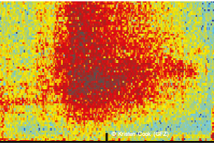
The drivers of geohazards
The research in this Subtopic involves a multidisciplinary analysis of the physical, chemical and rheological properties of the Earth, and its current and past states with respect to its geodynamic settings. The aim is to distinguish between a geosystem in equilibrium or steady state from one approaching instability, thus triggering extreme events. Ultimately, we seek to quantify the thresholds and transitions towards instability as input to ST3.2 and ST3.3.
Speakers: Christian Berndt (GEOMAR) and Sascha Brune (GFZ)

© Andrey VP AdobeStock
Temporal variations and the late stage before catastrophic events
The focus of this Subtopic is on a holistic investigation of temporal variations (transient phases) using laboratory experiments, modeling, and field observations over local, regional, and global scales. This involves understanding and modeling the fundamental physical processes that control temporal variations, requiring new monitoring approaches in order to separate long-term, steady-state behavior from short-term signals, to reduce the signal-to-noise ratio of the observables, and to identify emerging threats. While the natural Earth system will be the primary focus, events associated with geothermal and gas production activities (with links to T8) may be considered as ‘controlled’ experiments that will help in developing our understanding.
Speakers: Patricia Martinez-Garzon (GFZ) and Heidrun Kopp (GEOMAR)

Extreme events: characterization, cascades and impact
Coupled physical-chemical and mechanical models, including laboratory-, numerical- and probabilistic tools, will contribute to understanding the development of extreme events. Realistic scenarios, including uncertainties, will be developed and combined with numerical tools and web-based services for the simulation of single- and multi-hazard cascading events. The enhanced understanding, combined with data science developments, will facilitate innovative methods for event detection, simulations, and forecasting of possible ‘black swan’ events.
Speakers: Thomas Walter (GFZ) and Thor Hansteen (GEOMAR)

Translating hazard knowledge to risk mitigation
There are three objectives: i) raising community awareness and preparing decision-makers charged with long-term urban planning or site selection/design of critical facilities, ii) improving short-term (days, hours, seconds) warnings, and iii) contributing to rapid response and real-time information during the hours/days following a major event.
Speakers: Andrey Babeyko (GFZ) and Colin Devey (GEOMAR)